Before we can start to talk about the events of Day 26 we need to cover the late Evening of Day 25 and how it had an impact on the rest of the trip. Char and I started walking from our hotel in Glenwood Springs towards a local park where we were informed there would be a major fireworks show for Independence day. As we passed a Shell station there was a nice couple who maybe sensed we were indecisive on where we were heading and invited us to join them in their lawn chairs on the lawn of the station property.
It turns out they were the owners of the station a fellow by the name of Greg Beightel and his Wife who I never caught her name. While watching the fireworks Greg asked us where we were from and I gave my standard response of Winnipeg, Manitoba, Canada and was about to start to explain as I have had to this entire trip but Greg immediately responded with several responses and questions that showed he was pretty up on Canadian Geography. It turns out there is likely very few roads in the USA and a lot of Canada that Greg hasn't seen from the seat of a motorcycle.
After asking us about our travels to date Greg asked us our plans for the next few days of riding. I told Greg we were basically looking at slabbing it to Denver and then onto Cheyenne, WY before hitting some secondary highways on the way to South Dakota. Well by the time we left Greg's office at the station he had mapped us out some must ride roads with only 40 miles of super slab between here and Rapid City, S.D.
So if you are ever in Glenwood Springs, CO and need fuel, or want some info on great roads to ride then stop by and see Greg at the Glenwood Shell at the corner of 6th and route 82.
Day 26 was originally planned to be an off day after 3 straight days of riding but Char and I discussed how we seem to be hitting a wall physically during the trip and decided to alter our plans. So from here until we arrive home we are going to skip taking days off and instead reduce our miles covered per day. We both seem to be getting a bit saddle sore at this point with rest stops coming quicker each day so hopefully this approach will help.
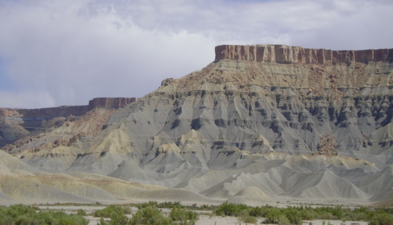
With this plan in mind we planned a very short day today and with Greg's help mapped out an interesting ride to Steamboat Springs, CO which I figured might provide some interesting places to visit with the extra time we would have upon arrival. We got off to a leisurely start later in the morning and immediately hit I-70 East bound coming out of Glenwood Springs. Considering this was going to be our only 40 miles of slab time it was actually about as interesting a ride as you could expect on an Interstate. The first 20 miles or so was through Canyons before opening up into rolling hills.
We left the Interstate at Wolcott and got on route 131 which was another wonderful motorcycle road (they seem to be endless in this part of the state) and headed North towards route 134. Before heading onward on 134 we stopped at the small burg of Toponas for a coffee for Char. This country store was a prime candidate for a spot on the show Hoarders. There was literally piles of stuff everywhere you looked.
Apparently anything can be recycled as a planter!
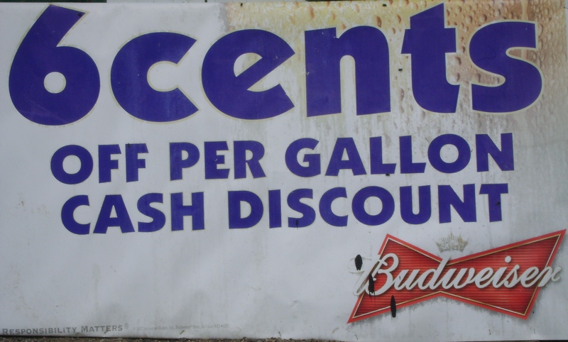
In my younger days I could put away the beer pretty good but I don't recall buying Budweiser by the gallon!
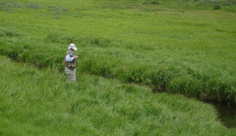
Shortly after going over Gore pass (9527 elev.) on route 134 we came upon this lady fly fishing in a very small stream. She had caught several small Brook trout and had just released a 12" rainbow trout as we were pulling up. Spent a few minutes talking with her husband who it turns out is also Canadian having grown up in Val D'Or Quebec.
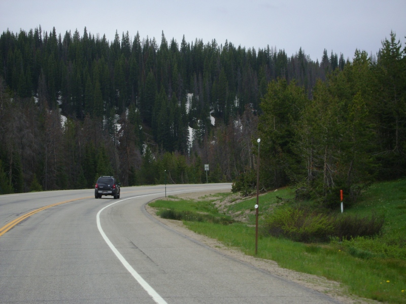
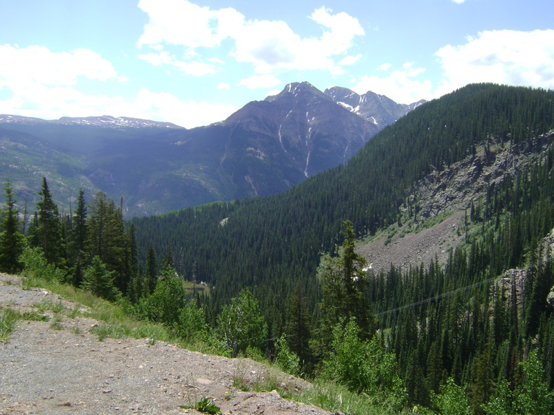
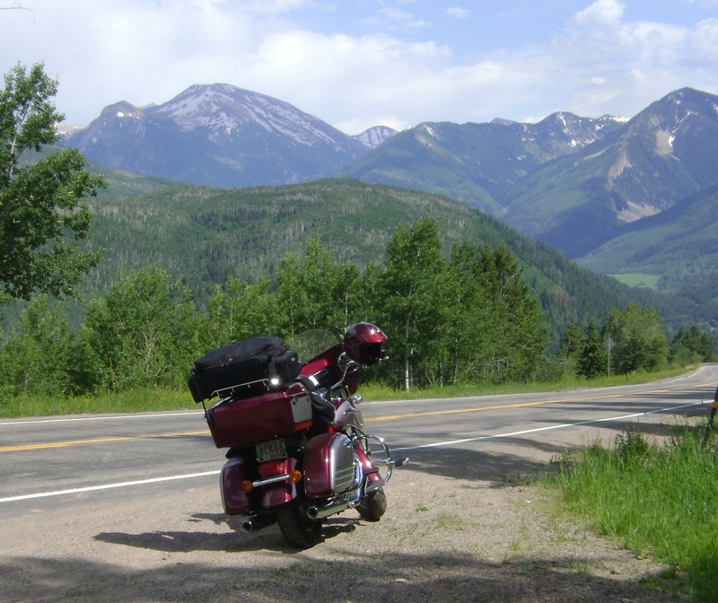
We turned off route 134 and headed North on Highway 40 towards Steamboat, part of why we took this route besides Gore pass was to come over Rabbit Ears pass. Rabbit Ears gets it's name from having two summits giving it the rabbit ear look. We were around 9600 elev. but I was shocked at how much snow was still in the tree lines in this area.
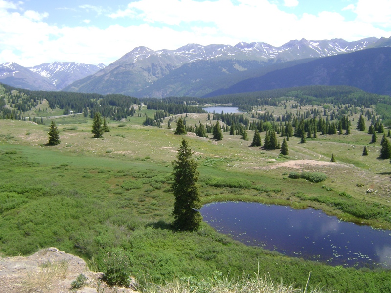
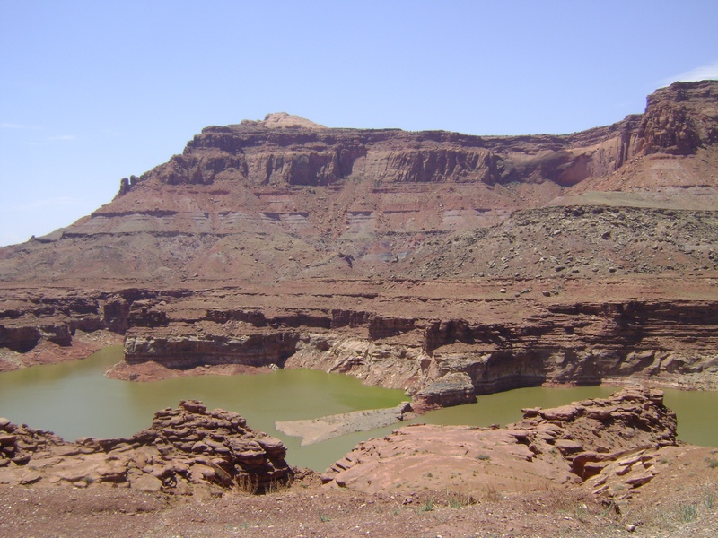
As you descend from the second Rabbit Ears summit you get some great views of the lake as you approach Steamboat Springs.
This is Carl Howelsen who ws the father of skiing in Colorado. He started a ski area right across the river from downtown Steamboat and a Winter carnival tradition that is still alive today.
With only riding a short distance today we needed to find a way to fill some of our time. Char had no trouble with this task as seen here.
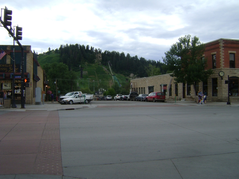
This is a view of Howelsen hill across the Yampa river from Downtown Steamboat.
Mileage covered today was 243.4 km bringing our trip total to 7694.6 km.
Tuesday, 5 July 2011
Monday, 4 July 2011
Day 25
We had a productive evening to end day 24, taking advantage of the laundromat next to our hotel as well as the nearby car was to blow some of the road grime off the Nomad.
Day 25 had one of the top Motorcycle roads in the USA on the agenda, the Million Dollar Highway which is also known as the San Juan Skyway. It has 242 turns over the 71 miles it covers and has three mountain passes that you climb to over 10,000 feet on the way over.
We stopped at the Molas Summit which was over 10,900 feet elevation. Spectacular views in every direction.
The view as we depart the Molas Summit rest stop.
It was hard to show it in this photo but the colors to this formation were incredible and against the greenery background it was something to see.
Char had the tough task of trying to show the twists of the road from the back of the bike. In this series of switchbacks we are on one section with two more immediately below us just a 15 mph switchback away.
I liked this photo so it's in the blog.
The people of Ouray were lining the streets as we rolled through which I thought was a little over the top since we're just regular folk. Char seems to think they were out for something to do with the 4th of July and a parade, guess we'll just have to agree to disagree.
A little Nomad glam shot on the downside of McClure Pass on Highway 131. Highway 131 between Hotchkiss and Carbondale may have moved to the top spot of my favorite roads to ride on this trip. Lots of twisties but none of the 15 mph switchbacks that I find break up the fun and rhythm in a ride.
We got chased by weather the last 100 miles into our destination of Glenwood Springs, CO but other than a few drops we managed to arrive rain free. It's raining as I prepare this blog entry but I'm hoping it will blow overs as we are looking forward to seeing some fireworks tonight for Independence day.
I'm not sure if it's the toll of 25 days on the road combined with hotels and restaurant food but it feels like the miles are getting tougher to get in each day. We may back down the mileage a bit on the remaining days of this trip. We are both sporting some pretty bizarre tan lines that we will have to address in short order at home as well.
Mileage covered today was 557.1 km bringing our trip total to 7451.2 km.
Day 25 had one of the top Motorcycle roads in the USA on the agenda, the Million Dollar Highway which is also known as the San Juan Skyway. It has 242 turns over the 71 miles it covers and has three mountain passes that you climb to over 10,000 feet on the way over.
I'm impressed Char got this photo, it wasn't long after we hit the road on highway 491 and came up on us fast. We stayed on 491 throught Cortez and onto Durango, CO
From Durango we headed North on Highway 550 or as previously mentioned the Million Dollar Highway. Immediately the scenery starts to pick up as you start climbing.We stopped at the Molas Summit which was over 10,900 feet elevation. Spectacular views in every direction.
The view as we depart the Molas Summit rest stop.
It was hard to show it in this photo but the colors to this formation were incredible and against the greenery background it was something to see.
Char had the tough task of trying to show the twists of the road from the back of the bike. In this series of switchbacks we are on one section with two more immediately below us just a 15 mph switchback away.
I liked this photo so it's in the blog.
The people of Ouray were lining the streets as we rolled through which I thought was a little over the top since we're just regular folk. Char seems to think they were out for something to do with the 4th of July and a parade, guess we'll just have to agree to disagree.
A little Nomad glam shot on the downside of McClure Pass on Highway 131. Highway 131 between Hotchkiss and Carbondale may have moved to the top spot of my favorite roads to ride on this trip. Lots of twisties but none of the 15 mph switchbacks that I find break up the fun and rhythm in a ride.
We got chased by weather the last 100 miles into our destination of Glenwood Springs, CO but other than a few drops we managed to arrive rain free. It's raining as I prepare this blog entry but I'm hoping it will blow overs as we are looking forward to seeing some fireworks tonight for Independence day.
I'm not sure if it's the toll of 25 days on the road combined with hotels and restaurant food but it feels like the miles are getting tougher to get in each day. We may back down the mileage a bit on the remaining days of this trip. We are both sporting some pretty bizarre tan lines that we will have to address in short order at home as well.
Mileage covered today was 557.1 km bringing our trip total to 7451.2 km.
Sunday, 3 July 2011
Day 24
Day 24 was another beautiful day with some more heat on the agenda. We left Escalante with a plan in question as our planned route was to head up Route 12 on our way towards I-70 before heading South again through Moab and on to Monticello. The question was brought up by our waiter last night who felt the trip North was a waste of 80+ miles and felt we wouldn't see much by passing by Moab. He felt we would be better served saving the 80 miles and heading south on Route 95 to 191.
Route 12 East of Escalante is a motorcyclists dream with non stop scenery and not a straight section of road in sight.
The view from the road side lookout right before the Kiva Koffehouse which sits on the edge of a cliff. 45 seconds after taking this photo we were passing through on the road below, it's a quick descent.
While Route 12 is a dream to ride you have to be cautious as it's also open range country and the cattle is pretty ignorant about who has the right of way at times.
Right after this was taken he started eyeballing us and came up onto the shoulder. I think he had sights on Char's red jacket, either way I was back on the throttle pretty quick.
These guys were more interested in retreating than coming forward, they broke into a run and a couple of bounds later were out of sight.
It's too bad the camera picked up so much of the cloud cover, the view from this turnout was incredible, nothing amazing just an endless landscape.
I believe this formation was called Chimney Rock.
This is the Historic one room schoolhouse in the town of Fruita in Capital Reef N.P.
Coming out the east side of Capital Reef the landscapes start to change with less color in the rock formations and an almost sand look to the hills.
When we stopped for gas in Hanksville we met a nice couple who started asking questions about the Nomad. During the conversation we learned they had spent extensive time around Moab. When asked about our route they shared the opinion of last nights waiter so our decision was made. Instead of heading North on 24 from Hanksville we went South on 95. This brought us to some fantastic scenery around Lake Powell.
Another view as we approach Lake Powell.
I don't know who Jacob is, but that's his chair on top of that Mesa.
As we approached our destination of Monticello, UT it looked like some weather was approaching on the horizon.
Mileage covered today was 422.1 km bringing our trip total to 6894.1 km.
Saturday, 2 July 2011
Day 23
In my last report I mentioned having clutch problems, well those problems turned our planned 3 day, 2 night stay in Las Vegas into a 6 day, 5 night stay. Clearly there is worse places to get stranded with mechanical problems so I'll count ourselves fortunate even though the lost days will affect our planned route from here.
After getting the bike back from the Ridenow dealership on Boulder highway late Friday night we were more than ready to hit the road Saturday morning. We opted for an early departure to try to get out from under some of the forecasted 111 degree high.
With our final night in Vegas behind us we left the lights of the strip behind us.
And headed for the open road. Not sure there is a better feeling than a clear sky and open highway in front of you.
Heading North out of Vegas on I-15 we briefly passed through Arizona before entering Utah. It felt like we were trying to make up for lost time as the flow on I-15 was a steady 80mph.
I might have expected this in Vegas but Utah?
Once off I-15 the scenery started to ramp up, this was near Hurricane Utah on the way to Zion National Park.
Waiting at a roadside stop while some large RV's came through a tunnel in Zion.
I had considered upgrading our camera after the Eagles photo earlier in the trip and this one pretty much confirms I'm shopping for a longer zoom point and shoot when we get home. There was at least seven mountain goats sitting up on the ledge.
Some of the scenery between Zion N.P. and Bryce Canyon.
Things start to get seriously cool looking as you approach Bryce canyon.
Running out of captions so I'll just include some more scenery.
Some Bryce Canyon wildlife.
Char at the far end of Bryce Canyon at the Rainbow Point lookout.
A view from Rainbow Point.
This was called the Natural Bridge, oddly enough found at the Natural Bridge lookout.
This one was taken at the Bryce Point lookout.
Char and I at the Bryce Point lookout.
One more from Bryce Point.
After being completely blown away by the scenery at Bryce Canyon it was off to our hotel in Escalante Utah.
Mileage covered today was 565.7 km, combined with 44 km of local riding in Vegas brings our trip total to 6472 km.
Subscribe to:
Posts (Atom)